
Mesquite ZIP Code Coverage
The local ZIP directory separates what is verified from what still needs an address-level check. Local and postal material supports 89027 as the ordinary central street-delivery ZIP and 89034 as a newer Mesquite delivery area. It also points to 89024 as a Mesquite-associated postal or PO-box reference, without a captured USPS classification. The nearby 89007 ZCTA belongs in regional context, not in a blanket city ZIP claim.
| ZIP Code | Areas Covered | Post Office | Notes |
|---|---|---|---|
| 89024 | Mesquite-associated postal or PO-box reference in local material | USPS classification was not exposed in the captured research | Unverified as street delivery or an incorporated-city boundary |
| 89027 | Central and ordinary Mesquite street delivery | Mesquite Post Office | Primary standard local ZIP; verify ZIP+4 for one address |
| 89034 | Newer Mesquite delivery area | Postal Bulletin identifies Mesquite office context | Established effective July 1, 2007; parcel check still matters |
| 89007 | Nearby Virgin Valley and Bunkerville-area ZCTA context | USPS service classification not established here | Not verified as a standard incorporated-Mesquite ZIP |
USPS assigns delivery ZIPs. Clark County and the City assign different legal and administrative geography. Census ZCTAs are statistical approximations of ZIP geography. A current ZIP can help validate a delivery address, yet it cannot establish ownership, occupancy, or whether a parcel sits inside the incorporated city.
Search Mesquite ZIP Codes
A ZIP narrows a place, not a resident list. The only confirmed local public directory with a postal-code or My ZIP control is the Mesquite Chamber directory, and it is a business and community-member directory rather than a household roll. The Assessor address search has no confirmed ZIP field, and the Recorder’s parcel and name searches use APN, name, date, and document choices instead. Treat a ZIP as a way to validate an address before selecting the record system that fits the question.
- Use USPS address tools or the local post-office route to verify the current delivery ZIP and ZIP+4 for a specific address.
- For a business or organization, use the Chamber postal-code control and label the result as a member or business contact, not a resident.
- For a parcel question, enter the street address or APN into the Assessor route, preserving the legal City/Town and situs details with the ZIP.
- For election research, use the County’s available county, district, precinct, or voter-file products under their access rules. No public ZIP filter was confirmed.
- Compare the recorded instrument, parcel, and postal result before making a historical or boundary claim.
Once a ZIP has narrowed a location to a street, use the Mesquite street directory for the address-by-address parcel and Recorder workflow. It adds legal-description and APN context that postal geography does not supply.
Mesquite ZIP Boundaries
Mesquite’s postal, legal, and statistical boundaries do not align perfectly. The Assessor explicitly says its City/Town field represents a legal boundary, not a mailing city. A Mesquite mailing label may reach nearby rural or unincorporated Virgin Valley territory, and Bunkerville is a distinct nearby settlement. A parcel must be checked against its APN, legal description, and City/Town result before calling it an incorporated-Mesquite parcel.
- ZIP and ZIP+4
- A five-digit delivery area and its four-digit extension, which can narrow a route or box but does not define a city line.
- PO-box ZIP
- A postal reference used for box service. It should not be called a street-delivery area unless USPS confirms that classification.
- Unique ZIP
- A ZIP used for one organization or location. No Mesquite example was verified in the captured research.
- Carrier route
- A delivery-route grouping used by USPS. It is not a parcel boundary or a list of people at an address.
City-limit check. A Mesquite ZIP does not establish an incorporated-Mesquite address. Preserve the mailing label, ZIP, APN, legal City/Town, and record date as separate facts.
For an unclear address, compare the parcel against city-boundary material and the recorded legal description. Route a new or ambiguous address question to Mesquite Development Services or Clark County GIS and Assessor, while preserving the legal parcel. Postal delivery confirms neither one by itself.
Note: Postal validation identifies a delivery assignment, while parcel and City/Town records answer the legal-boundary question.
Mesquite 89027 ZIP Area
89027 is the primary standard ZIP for central Mesquite street and mail delivery in the captured materials. The official USPS location identifies the Mesquite Post Office at 510 W Mesquite Blvd, Mesquite, NV 89027-9995. Its retail hours and PO Box access serve as a postal service point, not a complete map of every 89027 delivery address. USPS address validation remains the practical check for a specific ZIP+4.
The USPS Mesquite post-office listing provides an official source for the post-office location and 89027 ZIP+4 context.
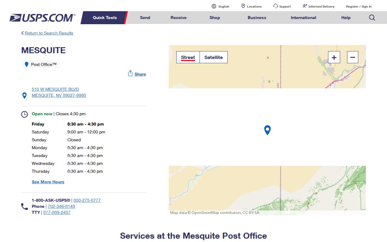
The listing confirms the post-office location and 89027 ZIP+4 context. It should not be read as a legal city map, a parcel record, or evidence about a person at a delivery address.
Clark County’s 2024 ZIP table estimated 19,728 people in 89027. That is a dated county planning estimate, not a Census count and not a resident directory.
Mesquite 89034 ZIP History
The Postal Bulletin notice identifies 89034 as a new Mesquite delivery-area ZIP effective July 1, 2007. That date is useful when checking a later address against older documents. Do not backdate 89034 to an earlier record without a period postal source, parcel record, or recorded instrument that supports it. A ZIP may change while the underlying legal description remains the stronger parcel identifier.
Clark County’s 2024 ZIP table estimated 4,134 people in 89034. It is a dated planning estimate, not a measure of incorporated city limits or a count of people at a selected address. For a current parcel question, use the Assessor’s address or APN route after USPS validates the delivery ZIP.
Note: The 2007 establishment date helps interpret later postal records but does not revise older address evidence.
Mesquite ZIP Count Context
Clark County’s 2024 ZIP table reports separate planning estimates for 89027 and 89034. The 19,728 estimate for 89027 and 4,134 estimate for 89034 describe those ZIP areas at the report’s stated time. They should not be added to a city population and presented as a new Mesquite total. The two geographic systems have different boundaries, and the figures do not identify people at individual addresses.
The contrast is useful as a caution against treating a postal label as a civic boundary. Census place counts, city estimates, county ZIP estimates, and library profile figures each use a source date and method. Keep the publisher, date, and geography with any number. For a parcel-level question, an APN and legal description remain more precise than a ZIP estimate.
Mesquite 89024 ZIP Reference
89024 appears in local and postal-reference material connected with Mesquite, often as a PO-box or postal lead. The captured USPS research did not expose its service classification or a complete delivery-area description. For that reason, 89024 remains an unverified postal reference here, not a confirmed street-delivery ZIP and not a proxy for the incorporated city.
When an older letter, box, or directory entry uses 89024, preserve its exact date, wording, and address type. Then compare the record with a period instrument, an Assessor parcel, and current USPS validation where appropriate. This prevents a PO-box reference from being mistaken for a home, parcel, or legal boundary.
Mesquite 89007 ZIP Context
89007 appears in Census materials for the nearby Mesquite and Bunkerville geography, but it is not verified in this research as a standard incorporated-Mesquite mailing ZIP. Census ZCTAs approximate postal geography for statistics. They can cross legal boundaries and are not USPS delivery maps. A surrounding ZCTA belongs in a regional search note, not in a claim that every address inside it is in the City of Mesquite.
This distinction is especially important for family history and older address research. Keep “Mesquite” versus “Bunkerville,” mailing label, legal City/Town, and ZIP in separate fields. The source date matters because a current delivery result cannot rewrite the geographic meaning of a historic record.
Note: A Census ZCTA can support regional context, but current USPS validation controls delivery questions for a specific address.
Mesquite ZIP Search Filters
Confirmed ZIP-aware searching is limited, so the field labels matter. The Mesquite Chamber directory allows a postal-code or My ZIP search along with broader business-directory controls. It can identify local organizations and contacts, but it is not an address roll. The Assessor and Recorder should not be described as ZIP-filter tools because the captured research confirmed no such field for either system.
| Field | How It Works | Limit |
|---|---|---|
| What are you looking for? | Keyword field in the Chamber directory | Returns member or business context, not a household result |
| Category | Directory category selection | Useful for organizations and services only |
| Postal code / My ZIP | ZIP-aware Chamber control | Does not verify a legal city boundary |
| A-Z and Search | Directory browsing controls | Does not prove a contact’s home address |
Voter data products have different geography. Clark County supplies weekly Active and All files, custom county or district products, and precinct walking lists under separate rules. The interactive voter-service field set was not exposed in the research, and no public ZIP filter was confirmed. Confidential voters are excluded from walking lists.
Mesquite ZIP Address Crosswalk
A sound Mesquite postal workflow keeps postal and legal facts side by side. Preserve the original street spelling, city label, ZIP, date, unit or box notation, and any ZIP+4. Search the Assessor address route by street name, leaving City/Town blank if jurisdiction is unclear, then save the APN and legal description. Query the Recorder by APN, party, document type, or year. Use USPS for current delivery validation and Census geography only as statistical context.
Address variants can include Mesquite Blvd or Mesquite Boulevard, First North or 1st North, direction abbreviations, lot or unit labels, PO Box formatting, rural-route labels, and Mesquite or Bunkerville mailing language. Keeping these variants prevents a postal short cut from becoming an incorrect geographic conclusion.
Note: A ZIP is a delivery label, while an APN and legal description tie a result to a parcel for records research.